
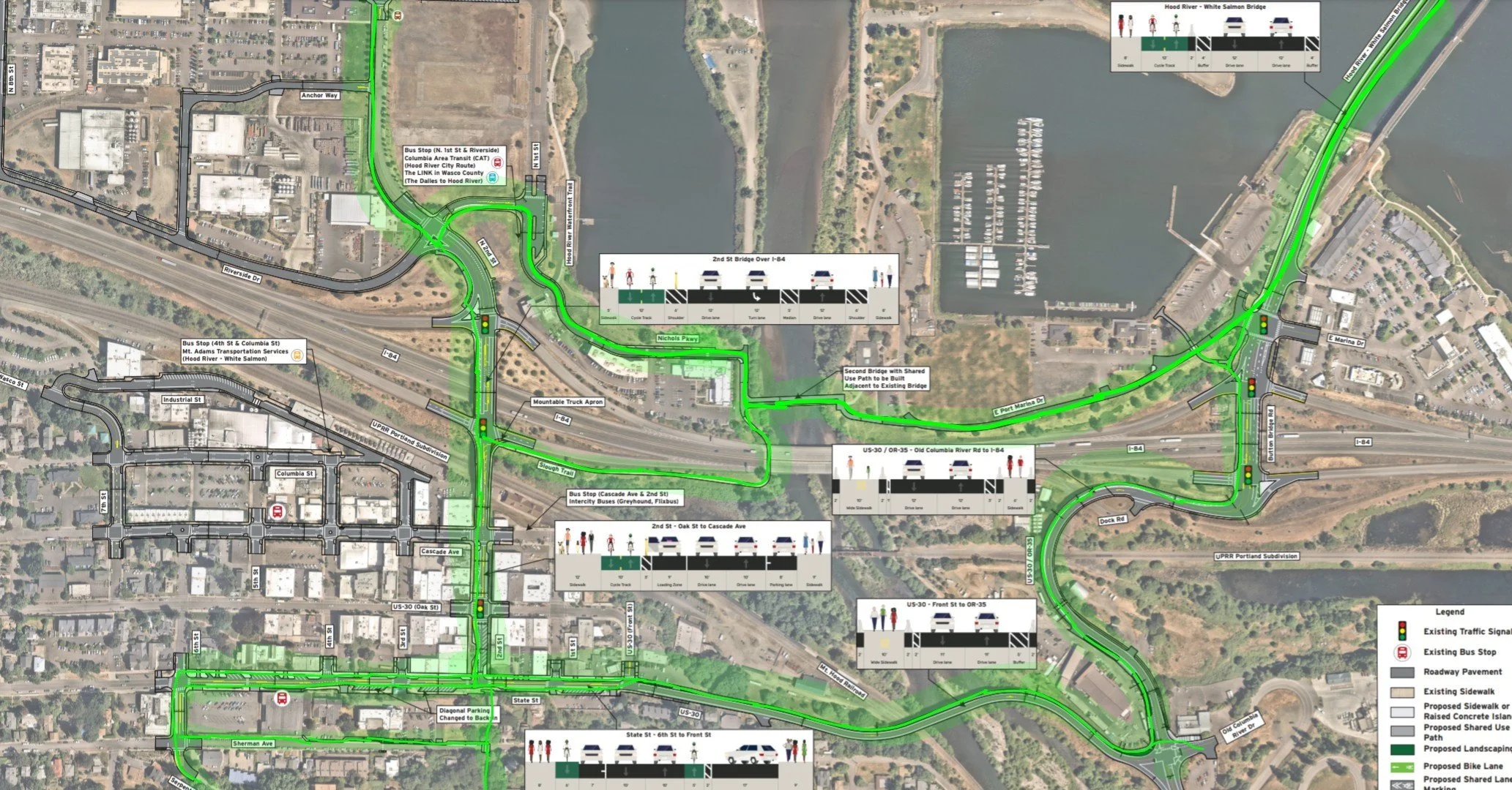
What are the proposed bikeways and walking routes from the new Hood River-White Salmon Bridge to each of the cities that it will connect?
The Opportunity
Creating an Action Plan
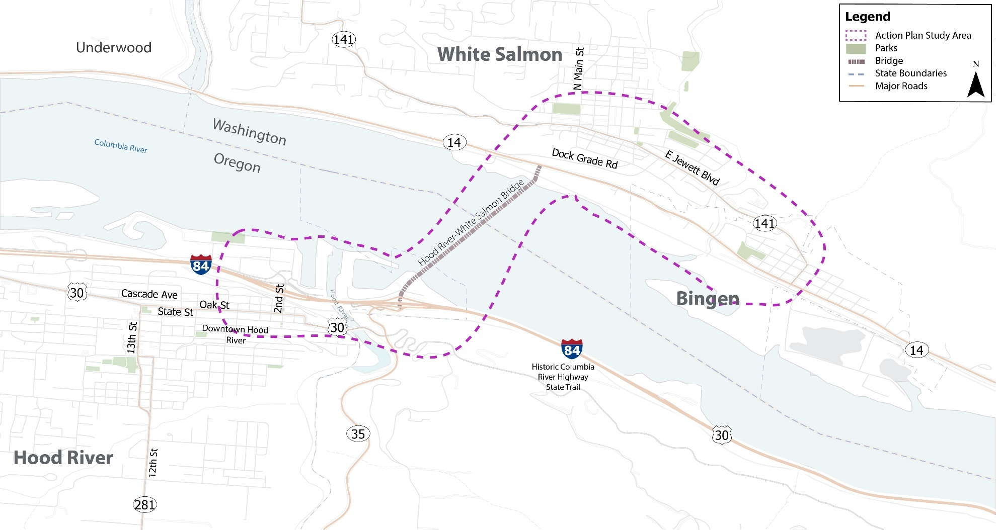
Where?
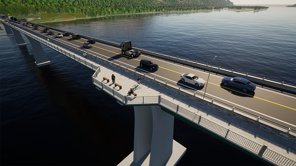
The new Hood River-White Salmon Bridge will provide bicyclists and pedestrians with direct access across the Columbia River, creating exciting new opportunities for recreation and stronger connections between communities on both sides. Whether you drive, bike, walk, roll, ride public transit, or anything in between, your voice matters to the future of mobility in Hood River, White Salmon, and Bingen.
The plan will assess current conditions, identify priority infrastructure needs, and recommend investments that enhance safety, mobility, and overall quality of life. Guided by community input and coordination across jurisdictions, the Action Plan will support a more connected transportation network for Hood River, White Salmon, Bingen, and the greater Columbia River Gorge.
The study area includes the transportation network within approximately 2 miles of the bridge, encompassing portions of the cities of Hood River, White Salmon, and Bingen.
Core Principles
The walking and biking network plan for the new bridge is guided by five core principles: Equity, Mobility, Access, Safety, and Economic Development.
DRAFT PLANS


KEY COMMENT
Please use the button below to submit a survey supporting the plans and include these 2 important comments for the Hood River side:
Comment 1: Maintain a two-way bikeway on the west side of 2nd Street from State Street to Portway. This will make biking between downtown and the waterfront safer and more convenient for people of all ages and abilities, while giving drivers a clearer expectation of where people biking will be.
Comment 2: Add “No Right on Red” signage where applicable at the I-84 interchange entrance and exit ramps.
Oregon Department of Transportation does not allow 2-way bikeways through interchange areas. Without an exemption, the design forces people biking to cross 2nd Street and the eastbound entrance ramp at one of the city’s most dangerous locations for pedestrians and cyclists.
This maneuver is especially risky for younger and older riders who may not have the agility or experience to navigate it safely. It is also inconvient and adds time to the total trip.
PROJECT TEAM
With the professional engineering and planning guidance of HNTB, the following organizations and stakeholders were involved in the creation of the action plan.